SAVI Talks
SAVI Talks, held once a semester, serve as a platform for fostering knowledge exchange on topics crucial for informing timely state legislative efforts. These discussions address pressing concerns such as the pandemic, wildfires, elections, and collaborative decision-making. This strategic direction positions SAVI as an ideal platform for leaders to drive conversations about the implications of Geographic Information Science for critical challenges. The aim is to establish SAVI as a thought leader and facilitator in discussions that contribute to informed decision-making on legislative matters.
Recent SAVI Talks
BayGeo / SJSU SAVI GeoEducation Summit IX

Join us for the ninth annual GeoEducation Summit, co-hosted by BayGeo and SJSU's Spatial Analytics and Visualization Institute! On Friday, September 11, 2026, educators, students, industry professionals, and researchers will gather at the Dr. Martin Luther King, Jr. Library in San Jose to explore the evolving geospatial landscape. The day features presentations, skill-building sessions, a student poster and web app showcase, and ample networking opportunities with Bay Area GIS leaders. Lunch is provided. Whether you're launching your career or shaping the future of geo-education, this is the community event you won't want to miss.
A Conversation on GIS Careers
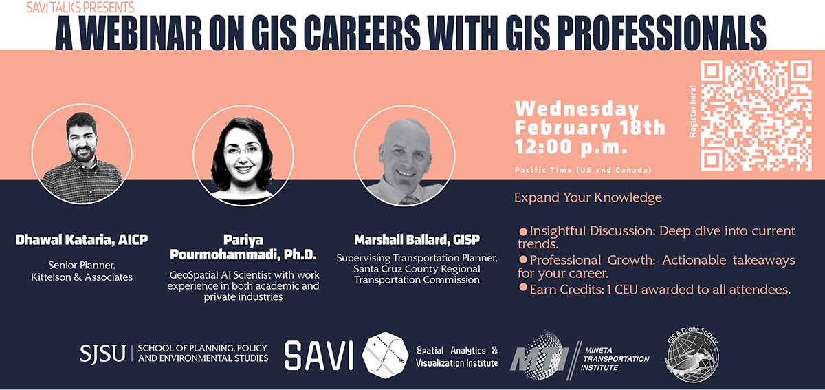
A Conversation on GIS Careers brings together professionals from transportation, entertainment, and higher education to explore how GIS skills translate into real-world careers. This webinar panel will discuss in-demand technical and analytical skills, emerging career pathways, and practical advice on crafting resumes that stand out in the GIS field. Co-sponsored by BayGeo and the Mineta Transportation Institute, the event is designed to help students navigate the evolving geospatial workforce and prepare for the next steps after graduation.
Earn 1 CEU by attending this webinar!
Artificial Intelligence and the Future of City Governance
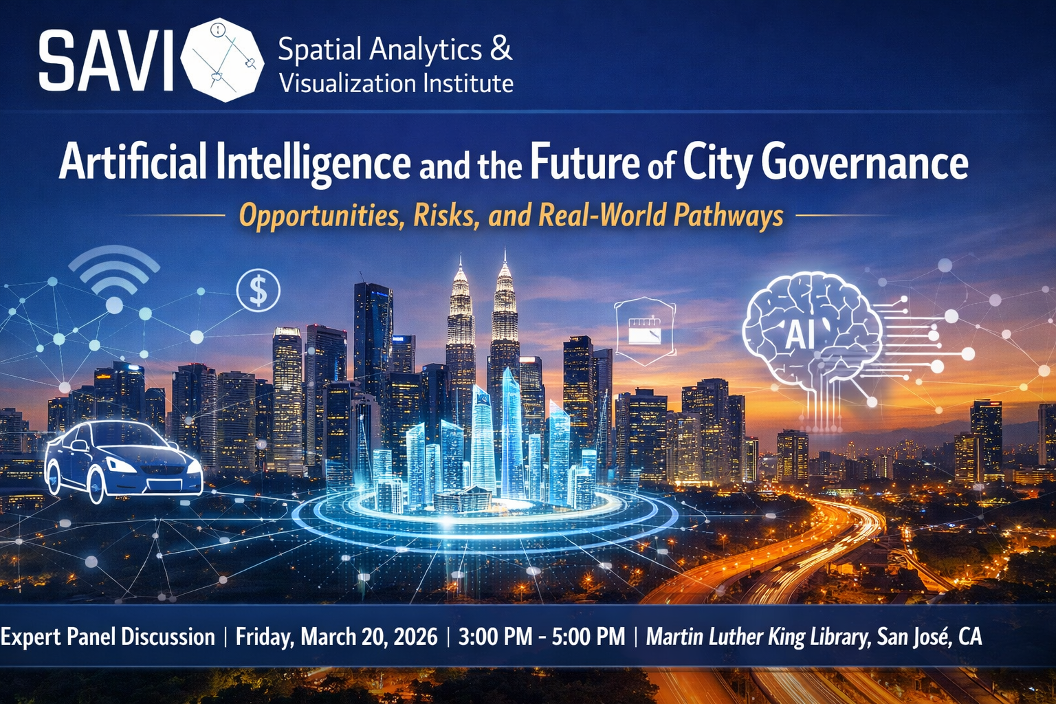
SAVI Talk: AI and the Future of City Governance
How is Artificial Intelligence reshaping the way we govern, move, and live in our
cities? Join the Spatial Analytics and Visualization Institute (SAVI) at SJSU for
an insightful panel on the opportunities and risks of AI in the public sector.
As cities transition toward data-driven decision-making, our experts will discuss real-world pathways for integrating AI into urban planning, municipal budgeting, and future mobility systems.
Featured Panelists:
Dr. Junghwan Kim: Director of Smart Cities for Good (Virginia Tech).
Keith Hertzberg: Budget & Innovation Advisor to Mayor Mahan (City of San Jose).
Dr. Yongsung Lee: Co-director of the 3 Revolutions Future Mobility Program (ITS).
Event Details:
When: Friday, March 20, 2026 | 3:00 PM – 5:00 PM
Where: Martin Luther King Library, Room 225 (150 E San Fernando St., San José)
Discover how Silicon Valley is leading the charge in balancing technological innovation
with equitable governance.
RSVP now to join the conversation.
From Pixels to Policy: Image Analysis in City Planning

This thought-provoking webinar brought together three leading scholars will show how images—from satellites to street-level views—are transforming the way we understand and design cities.
Dr. Marcel Moran (San José State University) studies transportation systems through imagery, open data, and fieldwork, with research that has directly influenced policy in San Francisco and New York City.
Dr. Ayda Kianmehr (San José State University) focuses on climate resilience, using microclimate modeling and machine learning to uncover how tree canopies, extreme heat, and community vulnerabilities intersect.
Dr. Maryam Hosseini (UC Berkeley) develops open-source, computer vision tools that help planners improve walkability, accessibility, and equity—addressing challenges from disability access to climate adaptation.
Attendees discovered how innovative image-based methods are driving new insights into transportation, environmental health, and social equity. This webinar will highlight real-world case studies and demonstrate how visual data can become a powerful tool for building healthier, more resilient, and more inclusive communities. Whether you’re a student, planner, policymaker, or community advocate, this event offers fresh perspectives on how images can help shape the future of our cities.
SAVI-CARHS Talk: GIS 4 Health Equity
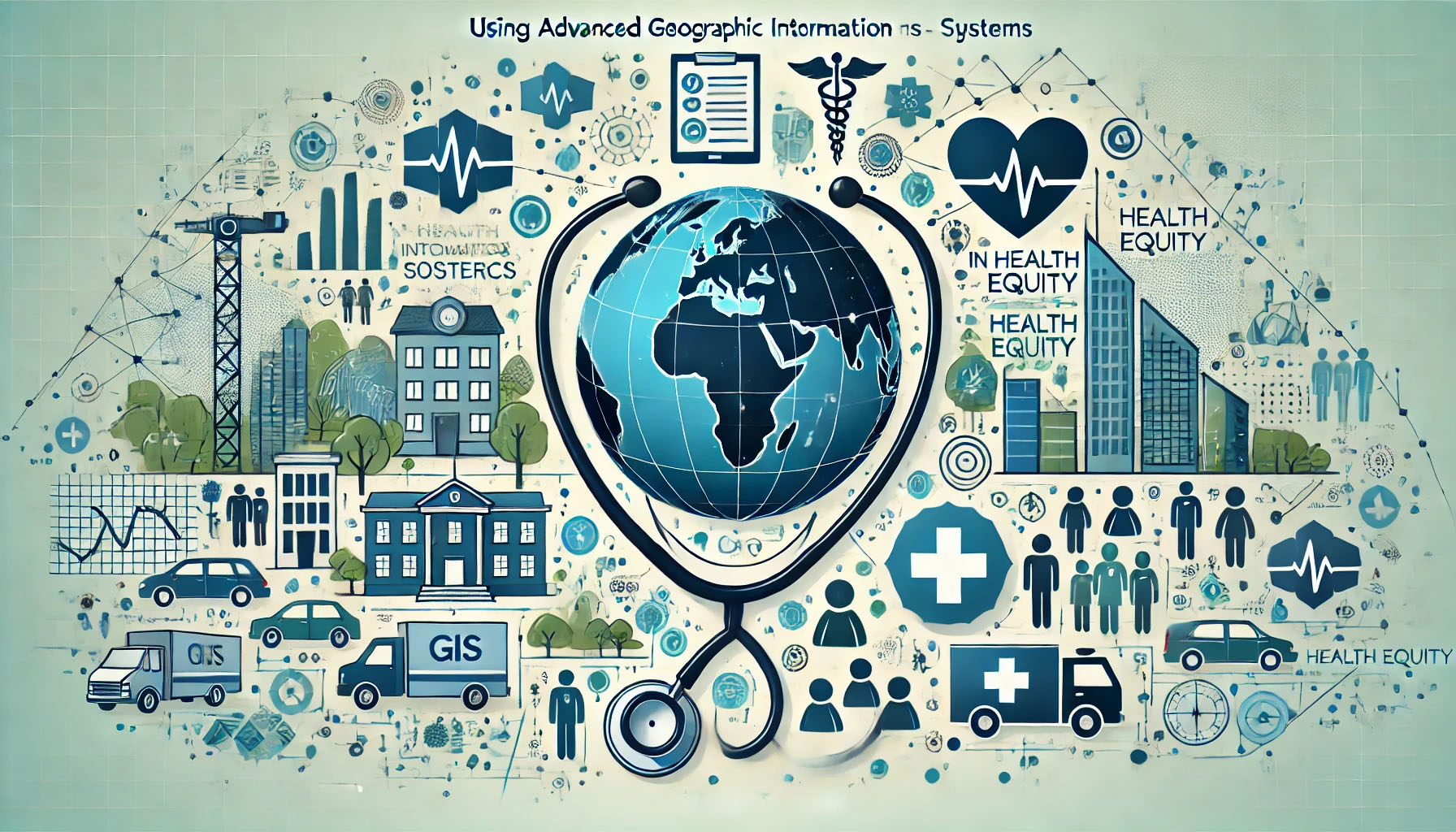
SAVI wass delighted to partner with the Center for Applied Research in Human Services (CARHS) at San Jose State University the next SAVI Talk, a webinar on Using Advanced Geographic Information Systems in Health Equity Research.
Digital Twins: Implications for Public Decision Making
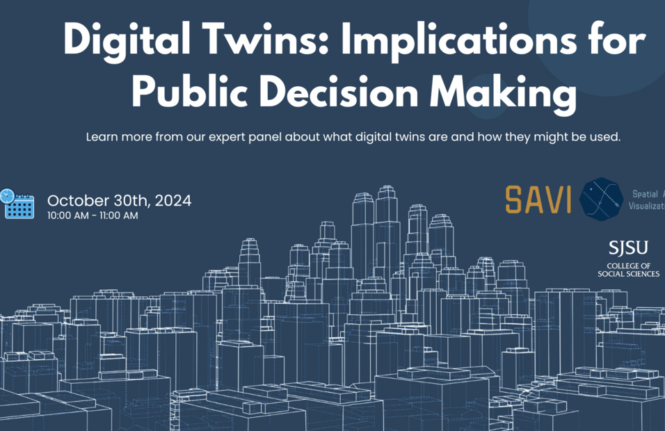
Digital Twins: Implications for Public Decision-Making, a conversation with experts from NVIDIA, Maynooth University, and the California Government Operations Agency. Explore how digital twin technology is transforming policy, urban planning, and public services. Discover the future of data-driven governance in this insightful discussion!
Urban High-Tech Zones & Strategic Planning for Smart Growth
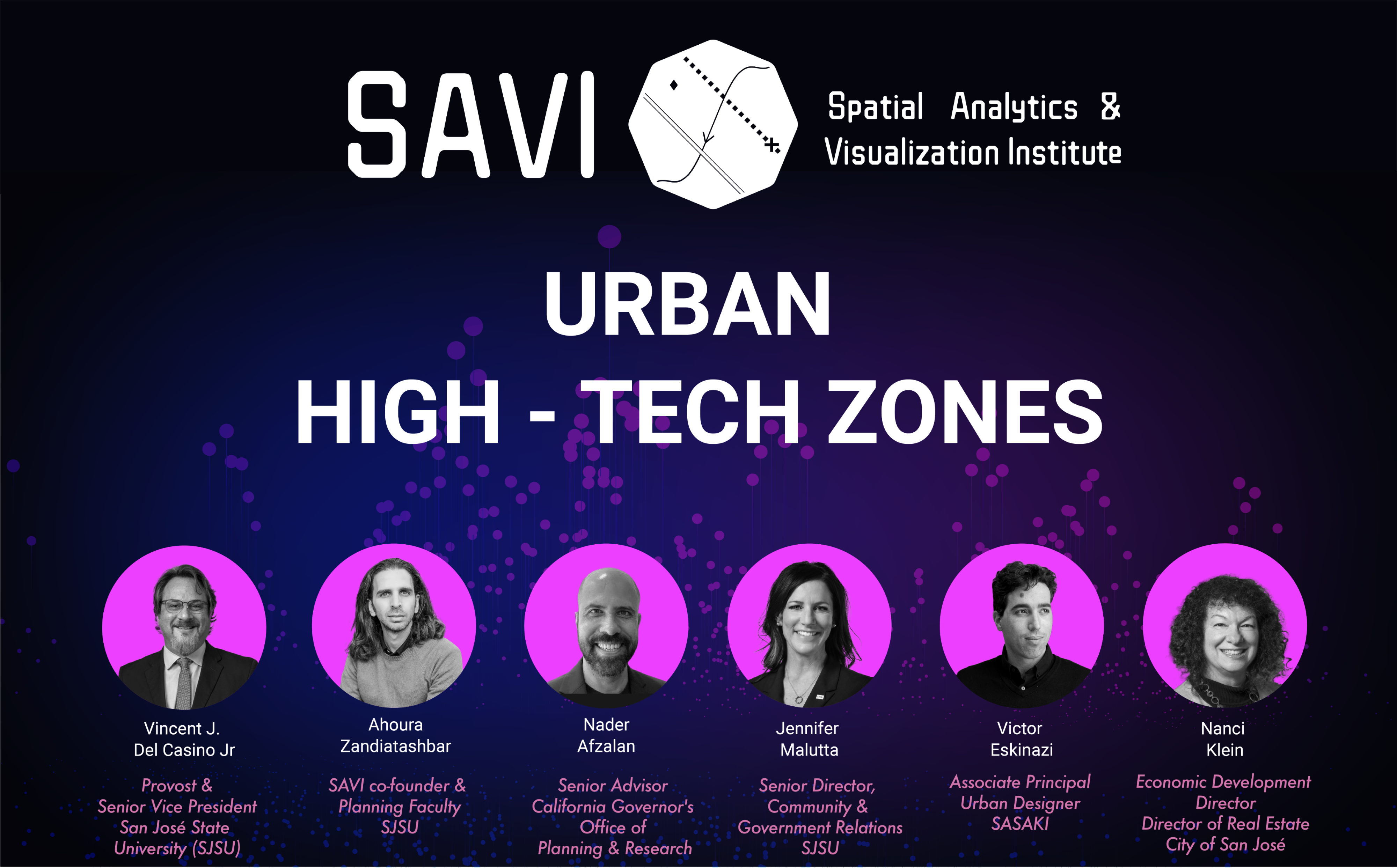
The SAVI Talk: Urban High-Tech Zones & Strategic Planning for Smart Growth hosted a panel discussion with the author of the book on urban high-tech zones, the Tecnológico de Monterrey urban design team, and Northern California policy, planning, and university leaders, focused on how cities can harness technology to create vibrant and sustainable communities. Our expert speakers will share insights on urban development, innovation, and the future of cities in the growing high-tech economy.
GISci and Mapping Implication for Environmental Studies and Sciences Research
In this SAVI GIS Talk event, we were honored to have two panelists (Dr. Serena Alexander and Dr. C.J. Gabbe) with a rich background in environmental studies and sciences research where they will share their recent research and findings and how mapping and GISci could support ENVS research.
Public Participatory Geography Research Panel
The Spatial Analytics and Visualization Institute (SAVI) of SJSU Department of Urban and Regional Planning in partnership with Mineta Transportation Institute, University of Central Florida, UC Davis, and Astronaut High School cordially invite you to Participatory Geography Research Panel with K12 Education March 24 4PM at San Jose Guildhouse. We have a team visit SJSU from the University of Central Florida and Astronaut high school with K12 teachers and students. We will share the costal mapping project using drones, GIS, and citizen science with K12 education supported by NSF RET.
Data Science and Collaborative Decision-making
On April 16, 2021, SAVI welcomed Department Chair, Dr. Laxmi Ramasubramanian, and Dr. Moira Zellner, Professor of Public Policy and Urban Affairs and Director of Participatory Modeling and Data Science in the College of Social Sciences and Humanities at Northeastern University, to discuss the application of participatory modeling and spatial analytics in projects that have become successful examples of community-driven planning.
Using GIS, Drones, and data science for Urban and Environmental Studies
The SJSU Spatial Analytics and Visualization Institute (SAVI) is delighted to welcome Dr. Bo Yang; a new SJSU faculty member in the Department of Urban and Regional Planning. Dr. Yang joins SJSU with an interdisciplinary education background including degrees in Applied Mathematics, Computer Science and Ph.D. in Geography that well positions him to advance SJSU scholarly and educational activities on GIScience, Unmanned Aerial Vehicle (UAV), Remote Sensing, Human-environment Interactions, and Citizen Science as his expertise is very supportive of forming evidence-based policies around environmental challenges in the state of California.
In this SAVI Talk, Dr. Yang will be presenting his advanced research on urban and environmental challenges with using GISci, drones, and data science.
CA Megafires
On March 12, 2021, SAVI guest speakers discussed California megafires, the California Fire Hazard Severity Zone (CFHSZ) web map, and implication of CFHSZ data for examining asset impacts to the City of Los Gatos.